Borders and Boundaries

Borderland: A fascination with borders and boundaries

I’ve long been fascinated by international borders and provincial boundaries. It started back in 1975-76. First, I decided in the Summer of 1975, between Grade 12 and 13 at Oshawa Catholic High School in Oshawa, Ontario, that I might was well catch a bus, head east, and then experience the end of the hitchhiking era. Part of that would involve borders. I recall walking across the Edmundston–Madawaska Bridge, an international bridge which opened in 1921 and connects the cities of Edmundston, New Brunswick, in Canada and Madawaska, Maine, in the United States, across the Saint John River. A new replacement bridge is currently under construction and scheduled to open in 2025.

I’m not sure quite what propelled me to walk over the river and into Aroostook County, Maine, but I think there was something about a girl in a bar in Madawaska (I know, sounds a bit like the opening salvo of a country-and-western song; I believe the legal drinking age may have been 18 in Maine at the time). I remember me back in Canada later sleeping in front of either Edmundston City Hall, or the Edmundston Police Force station (I’ve forgotten which, but the building was downtown, near the old S.M.T. (Eastern) Limited bus station, I think, in those days).

Remarkably, I only had a summer-weight sleeping bag and packsack (and notably no tent) in late June in the Maritimes.

My next stop would be camping out with the same gear in  Charlottetown in the back yard of the Government House of Prince Edward Island, often referred to as Fanningbank, where I was again neither disturbed or arrested, albeit I don’t recall then Lt.-Gov. Gordon Bennett inviting me in for some breakfast either.

A few days later, my sleeping back and I wound up camping out for the night atop some embankment, surrounded by cedar trees, I believe, in Truro, Nova Scotia. When I woke up the next morning my sleeping bag and I had descended about 30 yards down the embankment during the night, while my packsack was still back at top, marking where we had started out.

The following year was the United States’ bicentennial. To mark the occasion in 1976, Canada’s official gift to the United States on its bicentennial was a coffee table-size book, Between Friends/Entre Amis, which was chalk full of exquisite border photographs, and introduced me to the International Boundary Commission. I gave the book to my parents for their anniversary that year.

Between Friends/Entre Amis was where I learned about places like the Haskell Free Library and Opera House, situated at 93 Caswell Avenue in Derby Line, Vermont and 1 Church Street in Stanstead Quebec. It straddles two nations, with one foot in the United States and the other in Canada. A black line running along the floor – a strip of masking tape – marks the international border, separating the towns Derby Line, Vermont, from Stanstead, Quebec. The front door, community bulletin board and children’s books are in the United States; the remainder of the collection and the reading room is in Canada.

In the Summer of 1979, I lived briefly in Blaine, Washington, directly across from 0 Avenue in the Douglas neighbourhood of Surrey, British Columbia. The houses on the north side of the street right were in Surrey, the houses on the south side were in Blaine. My neighbours across the street had British Columbia licence plates visible in their driveways, while neighbours on either side of me had had Washington plates in theirs.

In 1983, I remember tagging along on a trip or two to Akwesasne with Richard Russell, when he was the circulation manager of The Standard-Freeholder in Cornwall, Ontario, and I was a daily newspaper reporter there. This is also around the time I came to love Lancaster, Ontario perch rolls in hot dog buns.

Akwesasne is an incredibly complicated and complex place. Was then and is now.

I may even have enjoyed a pint or two back in the 1980s in the Halfway House, a tavern also known as Taillon’s International Hotel, where the barroom straddles the Canada-United States border between Dundee, Quebec and Fort Covington, New York, and that was built in 1820 before the international border in that area was surveyed. I remember the demarcation line drawn on the floor by the pool table, and admonitions not to transport alcoholic beverages from Quebec into New York and vice-a-versa.

Perhaps this borderland and interprovincial boundary fascination runs in the blood. I remember going to my birth mother’s place for the first time in August 1999. She lived near Amherst, Nova Scotia, on Fort Lawrence Road, east of Exit 1, where the Via Rail Ocean passenger train, with its haunting but not at all unwelcome whistle filling the air, en route from Montréal to Halifax, or Halifax to Montréal, crossing the saltwater Tantramar marshes between Amherst, Nova Scotia and Sackville, New Brunswick, a stone’s throw from the Missiguash River, bordering New Brunswick and Nova Scotia and connecting the Nova Scotia peninsula with those who come from away elsewhere in North America.

The saltwater Tantramar marshes, sometimes referred to singularly as the Tantramar Marsh, is a very special place indeed, and was even long before the first train crossed it in the 19th century. Memory surrounds you everywhere in Nova Scotia. This is the soil my Acadian ancestors lived and laboured on.  This is Aulac Ridge, a prominent rise running west to east across the Tantramar marshes on the Isthmus of Chignecto, just west of the Missiguash River. This is the demarcation line between Fort Lawrence and Fort Beauséjour, New France and British North America, New Brunswick and Nova Scotia, overlooking the Cumberland Basin of the Bay of Fundy.

You can also follow me on Twitter at: https://twitter.com/jwbarker22

Standard
Canada

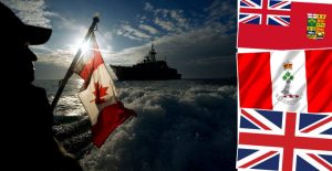
Celebrating our Maple Leaf flag on its 57th anniversary and in the third COVID-19 pandemic winter of our discontent

Canada’s flag, the Maple Leaf, was raised for the first time on Parliament Hill on February 15, 1965 – and that was 57 years ago today. Xavier Gélinas, curator of political history at the Canadian Museum of History in Ottawa, notes.

The Canadian Flag or the Maple Leaf Flag, was decided by a vote. A joint committee of the Senate and House of Commons voted for the present flag back in 1964. The final design was taken up by Parliament and approved by a royal proclamation after months of debate.

“It was an epic battle, and entire chapters and books have been written about the process. Not so much about the actual flag itself or the design of the flag, but about the very torturous process in which the design was finally reached,” said Gélinas. “The final act of the drama takes place between the Spring of 1964 and the last days of December 1964. The idea that Canada’s truly distinct national flag had been brewing and simmering with various intensities of heat since the early 20th century,” he added.

“Canada was flying the Red Ensign in 1870,” Canadian Military Family Magazine (https://www.cmfmag.ca/history/february-15th-marks-56th-anniversary-of-our-maple-leaf/) noted last year. “In 1892, merchant vessels registered in Canada flew the Red Ensign with only the four original provinces represented.” Canadian Military Family Magazine, based in Petawawa, Ont., is not officially affiliated with the Canadian Armed Forces or Department of National Defence. “In 1925, Prime Minister William Lyon Mackenzie King proposed the idea of a new national flag. He backed off after his proposal was met with protest against any attack on the Union Jack. He tried and failed again in 1945 with a joint committee of the Senate and House of Commons.”

The 1960’s-era Canada that gave birth to the Maple Leaf flag – a flag of our very own for the first time – is often nostalgically remembered as a time of incredible optimism and possibility, as it was in much of the world. And surely it was. We had our Centennial in 1967 and the International and Universal Exposition, or Expo 67, as it was commonly known, a Category One World’s Fair general exhibition, held in Montréal from April 27 to Oct. 29, 1967. It is considered to be the most successful World’s Fair of the 20th century with the most attendees to that date and 62 nations participating. It also set the single-day attendance record for a world’s fair, with 569,500 visitors on its third day.

Lest we forget, we also had in that same decade and into 1970 the Front de libération du Québec (FLQ). Writing in 2013 in the Canadian Encyclopedia, now known as Historica Canada, Marc Laurendeau and Andrew McIntosh noted  FLQ members – or felquistes – were responsible for more than 200 bombings and dozens of robberies between 1963 and 1970 that left six people dead (https://www.thecanadianencyclopedia.ca/en/article/front-de-liberation-du-quebec).

The FLQ was founded in March 1963 by two Québecers, Raymond Villeneuve and Gabriel Hudon, and a Belgian, Georges Schoeters, who had fought with the resistance during the Second World War. “Québec was undergoing a period of profound political, social and cultural change at that time,” wrote Laurendeau and McIntosh, as well as rising unemployment. Members of the FLQ or felquistes – were influenced by anti-colonial and Communist movements in other parts of the world, particularly Algeria and Cuba. They shared a conviction that must liberate itself from anglophone domination and capitalism through armed struggle. Their objective was to destroy the influence of English colonialism by attacking its symbols. They hoped that Québecers would follow their example and overthrow their colonial oppressors.”

Their actions culminated in the 1970 kidnapping of British trade commissioner James Cross and the kidnapping and subsequent murder of Québec cabinet Labour Minister Pierre Laporte, in what became known as the October Crisis.

The escalation of FLQ activities prompted Québec Liberal Premier Robert Bourassa to ask Liberal Prime Minister Pierre Trudeau to intervene. Trudeau, in turn, deployed the Armed Forces in Québec and Ottawa and invoked the 1914 War Measures Act – the first and only time it was ever used in a domestic crisis in Canada. Nearly 500 people were arrested without charge, including 150 suspected FLQ members.

Canada survived what appeared to many observers in 1970 to be an existential crisis. Whether the federal government was justified in invoking the now-repealed War Measures Act was controversial at the time and historians to this day still debate whether Pierre Trudeau did the right thing. Justin Trudeau invoking yesterday for the first time ever the 1988 Emergencies Act to deal with the trucker blockade and occupation of Ottawa, during this the third COVID-19 pandemic winter of our discontent, is also, of course, controversial. The Emergencies Act, which replaced the War Measures Act 34 years ago, was passed by in 1988 under the Progressive Conservative government led by former Prime Minister Brian Mulroney.

Sometimes we forget just how remarkable an achievement Canada, the land of back bacon, pickerel, the Maple Leaf, beaver, moose and the loon, was in 1867. In the spring of 1864, Nova Scotia, New Brunswick and Prince Edward Island were contemplating the possibility of Maritime Union. But nothing concrete happened until the Province of Canada, springing from the legislative union of Canada East and Canada West, heard of the proposed conference and members of the combined legislature requested permission to attend the meeting of the Maritime colonies, in order to raise the larger subject of British North American union.

Delegates from away arrived by steamer in Prince Edward Island and shared the spotlight with the first circus to visit the island in more than 20 years. No kidding. How absolutely Canadian can you get?

The historic Charlottetown Conference took place from Sept. 1 to 9, 1864. My ancestral Acadian roots are on the saltwater Tantramar marshes of Amherst, Nova Scotia, in Cumberland County on the Isthmus of Chignecto at the head of the Bay of Fundy and Missiguash River, bordering New Brunswick and Nova Scotia and connecting the Nova Scotia peninsula with those who come from away elsewhere in North America. From Amherst came four of the 36 Fathers of Confederation, more than any other city or town in Canada:  Robert Barry Dickey, Edward Barron Chandler, Jonathan McCully, and Sir Charles Tupper, a Conservative who went onto serve as Canada’s sixth prime minister briefly in 1896.  While he was born in Amherst, Chandler was best known as a New Brunswick legislator.

Tupper was also a medical doctor and founded Pugsley’s Pharmacy, dispensing chemists, at 63 Victoria Street East in downtown Amherst in 1843, the same year he became a doctor. Tupper was president of the Medical Society of Nova Scotia in 1863, and was the first president of the Canadian Medical Association from 1867 to 1870. Pugsley’s operated at the same location in the same historic Tupper Block building, as the oldest business in town and one of the oldest pharmacies in Canada, for 169 years until May 2012.

While there are differing historical opinions as to who should be considered a Father of Confederation, traditionally they have been defined as the 36 men who attended one or more of the three conferences held at Charlottetown; Québec City from Oct. 10 to 27, 1864; and London, England from Dec. 4, 1866 to Feb. 11, 1867 to discuss the union of British North America, preceding Confederation on July 1, 1867. Negotiators settled on the name “Dominion of Canada,” proposed by the head of the New Brunswick delegation, Samuel Leonard Tilley.  The word dominion was taken from the King James Bible: “He shall have dominion also from sea to sea, and from the river unto the ends of the earth” (Psalm 72:8). Tilley, who had a background in pharmacy, became the minister of customs in Sir John A. Macdonald’s first cabinet in 1867.

As a Canadian, it also remains an uncommon privilege for me to have to sat in the public gallery in the balcony of historic Province House in Charlottetown, designed and built by local architect Isaac Smith and completed in 1847, to accommodate the legislative assembly of Prince Edward Island. To this day, the assembly has only 27 seats for the members from the ridings of Souris-Elmira through to Tignish-Palmer Road.

The July 1 holiday was established by statute in 1879, under the name Dominion Day. There is no record of organized ceremonies after the first anniversary, except for the 50th anniversary of Confederation in 1917, at which time the new Centre Block of the Parliament Buildings, under construction, was dedicated as a memorial to the Fathers of Confederation and to the valour of Canadians fighting in the First World War in Europe.

The next celebration was held in 1927 to mark the Diamond Jubilee of Confederation.

Since 1958, the federal government has arranged for an annual observance of Canada’s national day on July 1.

The saltwater Tantramar marshes, sometimes referred to singularly as the Tantramar Marsh, is a very special place indeed, and was even long before the first train crossed it in the 19th century. This is Aulac Ridge, a prominent rise running west to east across the Tantramar marshes on the Isthmus of Chignecto, just west of the Missiguash River. This is the demarcation line between Fort Lawrence and Fort Beauséjour, New France and British North America, New Brunswick and Nova Scotia, overlooking the Cumberland Basin of the Bay of Fundy.

Memory surrounds you everywhere in Nova Scotia. This is the soil my Acadian ancestors lived and laboured on. All I have to do is close my eyes for but a moment listening to Lorena McKennitt’s The Mystic’s Dream, and I clearly hear the words, “All along the English shore,” and in my mind’s eye I see the Acadian tricolor of blue, white and red, the gold star Stella Maris at top left, seeking the guidance and protection of the Virgin Mary, patron of the Acadians.

My land. My country. My Canada. My flag.

You can also follow me on Twitter at: https://twitter.com/jwbarker22


Standard
Canada, Canada Day, Canada's North

From the Missiguash River to the Mackenzie Delta, breathtaking, raw beauty

This is a land bigger than the imagination – for all of us. In the Northwest Territories, the Akaitcho say, “‘Denech’anie,’ meaning ‘the path the people walk’ and that ‘we will live on the land as long as the sun shines, the river flows, and the grass grows.”

I’ve driven across the Western Arctic’s Mackenzie Delta; summer at 68 degrees latitude and the vast, open land at the top of the world, listening to Robin Mark’s “Revival In Belfast (Hope In The City)” and Susan Aglukark’s powerfully haunting song, “E186,” about what it meant to be an “Eskimo” with a number and no name, cranked up to full volume. With its raw power, it served as a defining moment in helping me to understand, if imperfectly and incompletely, the difference in what it meant to be Inuit rather than qallunaat (which, loosely translated from Inuktitut, is not terribly flattering, as it translates a bit closer to honky than white) North of 60 in the 1940s and 1950s.

Inuvik lives for me as a kaleidoscope of snapshots. One of the most vivid standing on the shore of the mighty Mackenzie River watching a flotilla of small boats head out in miserable weather for Aklavik.

The Gwich’in and Inuvialuit were gathering to bury three of their own: Doug Irish, Larry Semmler and Charlie Meyook. Northerners, aboriginal and non-aboriginal, look after their own.

Hundreds of Gwich’in, Inuvialuit and white men travelled by river and by air from Inuvik, from McPherson, from Tsiigehtchic, from the Yukon, from Alaska and from the South for the funerals at All Saints Anglican Church in Aklavik, on the site of the original Anglican Cathedral of the Arctic. The women volunteered to cook the community feast; the men hunted caribou and dug graves, all giving aid and comfort to their brothers and sister in Aklavik.

The Northwest Territories is a vast and open land, where two of the highest virtues practiced are tolerance and respect. I’d come home from work that first October in 2001 to my apartment on the shores of Great Slave Lake, and read more and more of Bern Will Brown’s Arctic Journal and  Arctic Journal II (a colleague had wisely recommended Brown’s writing as a good introduction to the Northwest Territories).

One dark December day, l got a sense of how imaginatively the lives of the peoples of the Circumpolar North are weaved together, between glances out my balcony window before 3 p.m. darkness fell and watching Smilla’s Sense of Snow, the delightful 1997 Danish thriller starring Julia Ormond, Gabriel Byrne, and Richard Harris, based on the 1992 novel Frøken Smillas fornemmelse by Danish author Peter Høeg, with both the book and the film telling the story of a transplanted Greenlander, Smilla Jasperson, who investigates the mysterious death of a small Inuit boy who lived in her housing complex in Copenhagen. Clues send her not just around Copenhagen, including the Hotel d’Angleterre, but also to Kiruna, the northernmost town in Sweden in Lapland, and Ilulissat in western Greenland.

I remember the first time I heard Stan Rogers’ “Northwest Passage” performed in the Northwest Territories in Yellowknife, with seemingly everyone in the audience in a school auditorium raising their voices in unison to join in. One of those moments that still send chills up your spine years later. I’ve long forgotten who performed it that night some 20 years ago almost now, but I haven’t forgotten it was a Stan Rogers song, and thinking the Bard of Guysborough County was truly one of Canada’s poets, a coast-to-coast-to-coast national treasure.

We are a country blessed with national treasures. Rhonda Payne, author of the play “Stars in the Sky Morning,” a tale of the hardships of women on the Northern Peninsula of Newfoundland – was a playwright the National Post described as a “national treasure” in 1999. Rhonda was a fiery actor, writer, director, producer and activist from Curling, who would go onto co-found Ground Zero Productions with Don Bouzek in Toronto, and after that Riverbank Productions in Peterborough, Ontario on Parkhill Road East (the studio office was quite literally on the banks of the Otonabee River).

From Churchill, Manitoba, I’ve had the chance to sail a beluga-populated Hudson Bay, across the invisible maritime boundary that divides Manitoba from Nunavut, and share the Seal River with polar bears. Churchill Airport was built by the United States military in 1942 and owned and operated by Transport Canada as a remote airport since 1964. Churchill Rocket Research Range, also built by the United States Army, under the aegis of Canada’s Defence Research Board in 1956, operated 23 kilometres east of town, where the Churchill Northern Studies Centre now is, until 1985.

I remember the haunting but not at all unwelcome sound of the train whistle when I would visit my mother, who lived near Amherst, Nova Scotia, on Fort Lawrence Road, east of Exit 1, as the Via Rail Ocean passenger train, en route from Montréal to Halifax, or Halifax to Montréal, crossed the saltwater Tantramar marshes between Amherst, Nova Scotia and Sackville, New Brunswick, a stone’s throw from the Missiguash River, bordering New Brunswick and Nova Scotia and connecting the Nova Scotia peninsula with those who come from away elsewhere in North America.

The saltwater Tantramar marshes, sometimes referred to singularly as the Tantramar Marsh, is a very special place indeed, and was even long before the first train crossed it in the 19th century. Memory surrounds you everywhere in Nova Scotia. This is the soil my Acadian ancestors lived and laboured on. All I have to do is close my eyes for but a moment listening to Lorena McKennitt’s The Mystic’s Dream and I clearly hear the words, “All along the English shore,” and in my mind’s eye I see the Acadian tricolor of blue, white and red, the gold star Stella Maris at top left, seeking the guidance and protection of the Virgin Mary, patron of the Acadians.

This is Aulac Ridge, a prominent rise running west to east across the Tantramar marshes on the Isthmus of Chignecto, just west of the Missiguash River. This is the demarcation line between Fort Lawrence and Fort Beauséjour, New France and British North America, New Brunswick and Nova Scotia, overlooking the Cumberland Basin of the Bay of Fundy.

Nowhere, of course, in the song are the words, “All along the English shore” actually heard, not even as a mondegreen where you mishear the lyrics to a song, which is a sort of aural malapropism, where instead of saying the wrong word, you hear the wrong word as a result of near-homophony, in a way that gives it a new meaning. No, this, as it was for Marcel Proust, is remembrance of things past.

I spent a balmy Maritime spring evening reporting from Middle Musquodoboit Harbour on the Eastern Shore’s Musquodoboit Harbour River, while I’ve travelled deep in the woods near Earltown in Colchester County, on the north slope of the Cobequid Mountains, searching for Willard Kitchener MacDonald, the so-called “Hermit of Gully Lake,” who had gone AWOL in 1945 after being conscripted and abandoning a troop train during the Second World War. Canada declared an amnesty for army deserters in 1950, but MacDonald, retained a lifelong suspicion of government and police. In the same area, I later returned to Sugar Moon Farm, also near Earltown, in search of maple syrup stories, while travelling the back roads of Folly Lake-Folly Gap-Folly Mountain, and through the Cobequid Mountains and Wentworth Valley to Londonderry, formerly known as Acadia Mines, in Colchester County, where time appeared to have stood still.

You can also follow me on Twitter at: https://twitter.com/jwbarker22


Standard
Acadians

Fête nationale: Long live Acadie, long live the Tintamarre

TintamarreCornwall Street

My name likely doesn’t immediately point to my Acadian ancestry. But indeed my birth mother came from a long line of LeBlancs and Cormiers, who settled on both sides of the saltwater Tantramar Marsh straddling the Nova Scotia and New Brunswick provincial boundary at the Missiguash River. This is the soil of Acadie where my Acadian ancestors lived and laboured near Aulac Ridge, a prominent rise running west to east across the Tantramar Marsh on the Isthmus of Chignecto, overlooking the Cumberland Basin of the Bay of Fundy. It also from Acadie that more than two-thirds of the Acadian population was expelled by the British between 1755 and 1764 during Le Grand Dérangement.

My mother, who lived for many years in Southern Ontario, returned to live on the Tantramar Marsh between Sackville, New Brunswick and Amherst, Nova Scotia, on Fort Lawrence Road, in the early 1990s. She spent the last 15 years or so of her life living just a couple of kilometres away from the modest two-storey house she had grown up in at the corner of Cornwall and Cordova streets in Amherst. The home remained in the family for generations until the last family resident, my uncle Harold Cecil Hicks, who spent most of his life living there, died in September 2013.

My mother didn’t talk much about her ancestry, although she acknowledged it in that way Nova Scotians have of accepting something but stopping somewhat short of perhaps fully embracing it, leaving room for lots of ambiguity. My family is big on ambiguity. When I first saw a photograph of my maternal grandmother, Adeline LeBlanc, who I never met, and mentioned to my mother how aboriginal she appeared to be to me, my mother told me she was “part Mi’kmaq.” Somehow that just hadn’t come up before my observation.  The Acadian side of our ancestry didn’t get stressed a whole lot more, truth be told, although my mother seemed to be more conversant in French than I’ve ever been.

People are products of their times. I could hardly expect my mother, who grew up in rural Nova Scotia in the 1940s and 1950s, to be trumpeting her Acadian or Mi’kmaq ancestral heritage.

Still, I saw the momentary anxiety show on her face, quickly followed by a look of pride, when she came home one day and “Nita’s boy” as my Nova Scotia relatives call me, abbreviating her name Juanita, had affixed outside her house the Acadian tricolor of blue, white and red, the gold star Stella Maris at top left, seeking the guidance and protection of the Virgin Mary, patron of the Acadians. It wasn’t lost on my mother, living on a road named Fort Lawrence, that we were standing on some of the most contested land in North America, where New France made its last stand some 250 years earlier against British North America, and even some American colonists from New England came up for a bit of skirmishing from time-to-time. The Acadian pennant flew outside of her house, faded after a few years in the sun and saltwater breeze off Cumberland Basin, for the rest of her life.

All of this comes to mind perhaps because Fête nationale nationale des Acadiens et des Acadiennes will be marked by annual celebrations again Saturday.

After a full two weeks of its own special brand of joie de vivre, marked by the “clangour” or “din” of musical merriment known as the Tintamarre, the 53rd annual Festival acadien de Caraquet on Nouveau-Brunswick’s Péninsule acadienne wraps up Saturday with revelers making as much noise as they can to celebrate Fête nationale, or more formally, nationale des Acadiens et des Acadiennes on 15 Août.

First held in 1955 to commemorate the bicentenary of  Le Grand Dérangement of the Acadians from the Maritime provinces, the Tintamarre takes its inspiration from a medieval French custom during which a crowd makes as much noise as possible in order to mark a sad or a joyful event.

You can also follow me on Twitter at: https://twitter.com/jwbarker22

Standard